Your Account
|
Sign Out
|
Contact Us
Available Products
All Products
Available Products
Sold Products
Category: Maps
Advanced Search
Search
Available
All
Available
Sold
Category: Maps
Close
Advanced Search
Home
More Topics
Maps
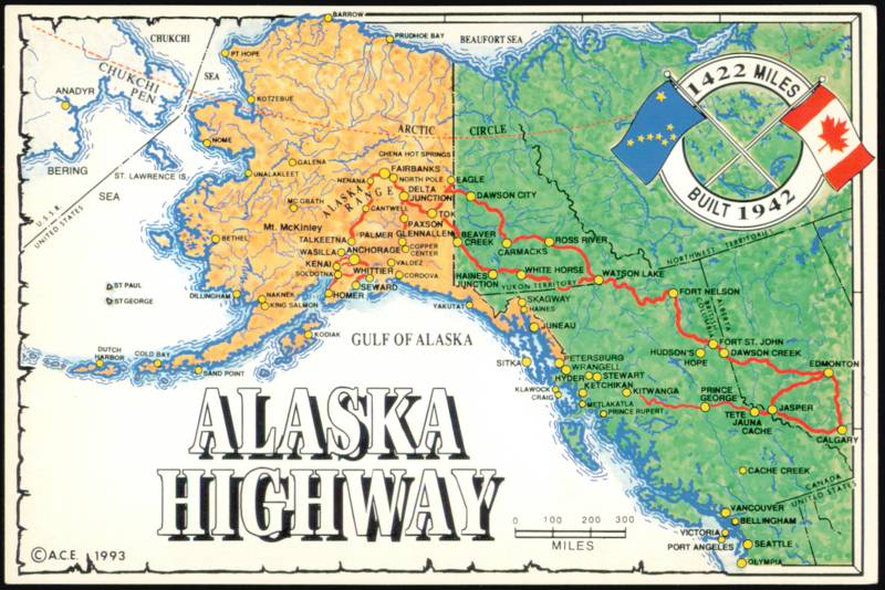
Illustrated Route Map of the Alaska Highway
Original Vintage Card
Add to Cart
Price:
$9.95
Stock #:
1217896
Type:
Postcard
Era:
Continental Chrome
State:
Alaska (AK)
Publisher:
Arctic Circle Enterprises
Size:
4" x 6" (10.25 x 15.25 cm)
Publisher's Series #:
ACE-932
Additional Details:
Illustrated route map tracing the 1,422-mile Alaska Highway built in 1942, connecting Canada and Alaska.
Add to Wishlist
Comments & Reviews
Ask a Question
Previous Product
Next Product
Post a public comment, question or review:
Your Name or Email
:
(Will be shown with your post)
*
Your message
:
Your Name and Message will be posted
publicly
(Email addresses OK, any HTML/tags
or commercial spam will be removed)
*
Enter these numbers:
Get a different code
*
Image verification
Submit