
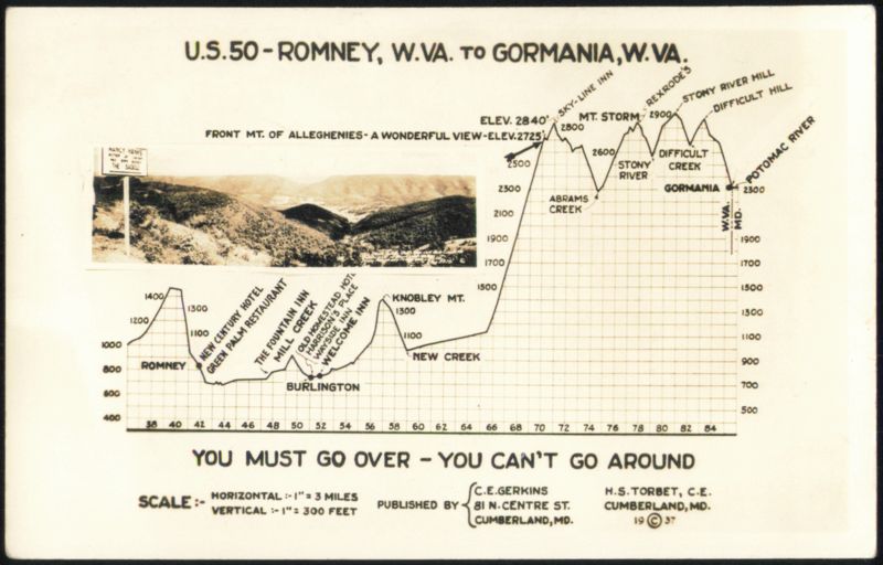
US 50 Romney to Gormania, West Virginia Elevation Profile
Additional Details:
| Map showing the elevation profile of U.S. Route 50 from Romney, W.Va. to Gormania, W.Va., with an inset photograph of Front Mt. of Alleghenies. Key landmarks and elevations are marked along the route, including towns like Burlington and points like Sky-Line Inn, Mt. Storm, Stony River, and Potomac River. The scale indicates 1 inch horizontal equals 3 miles, and 1 inch vertical equals 300 feet. Published in 1937. |

