Front:
50
KANSAS CITY
SEDALIA
50
ST. LOUIS
VERSAILLES
JEFFERSON.
CITY
50
65
ELDON
WARSAW
(54)
66
HURRICANE DECK
BRIDGE
BAGNELL DAM
LAKE OZARK
• ROLLA
GRAND GLAIZE BRIDGE
OSAGE BEACH
54
LAKE
LINN CREEK
NIANGUA
CAMDENTON
FORT
LEONARD WOOD
BRIDGE
• NEVADA
OF THE
(54)
MACKS
BAGNELL DAM
"НАНА-
5.
CREEK
TONKA
OZARKS
LEBANON
MISSOURI
66
SPRINGFIELD
CURT TEICH & CO., INC.
Back:
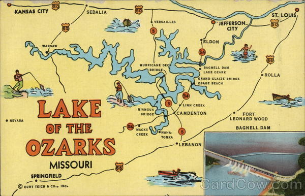
The Lake of the Ozarks—one of the largest
lakes in the U.S.A.-is formed by a huge
dam across the Osage River. The lake covers
an area of 95 square miles, is 129 miles long.
and has a scenic shore line of over 1,300 &
miles. Bagnell Dam is located 42 miles south i
of Jefferson City State Capital) on U.S. 54--
approximately halfway between Kansas City
and St. Louis.
Come to the Lake of the Ozarks
and enjoy a fine vacation.
5 B165-N
CORWIN NEWS AGENCY, JEFFERSON CITY, MO.
